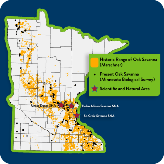
As an AmeriCorps Member serving with the Minnesota Scientific & Natural Areas Program within the Department of Natural Resources, I remediated existing PDF site maps to make them Geo-capable PDFs using GIS and design tools like ArcMap, Adobe Illustrator, and Adobe Acrobat. These PDF maps will show the users live location when opened in a phone application like Avenza Maps. In total, I updated 65 site map PDFs to make them GeoPDFs.

These maps are available to download at the bottom of each listing for a Scientific and Natural Area site.